Operational Forecast System
Operational Forecast System Description
The primary objective of the National Operational Coastal Modeling Program (NOCMP) is to develop and operate a national network of Operational Nowcast and Forecast Hydrodynamic Model Systems (called OFS) to support NOAA's mission goals and priorities. An OFS consists of the automated integration of observing system data streams, hydrodynamic model predictions, product dissemination and continuous quality-control monitoring. State-of-the-art numerical hydrodynamic models driven by real-time data and meteorological, oceanographic, and/or river flow rate forecasts will form the core of these end-to-end systems. The OFS will perform nowcast and short-term (0 hr. - 48 hr.) forecast predictions of pertinent parameters (e.g., water levels, currents, salinity, temperature, waves) and disseminate them to users.
Nowcasts and forecasts are scientific predictions about the present and future states of water levels (and possibly currents and other relevant oceanographic variables, such as salinity and temperature) in a coastal area. These predictions rely on either observed data or forecasts from a numerical model. A nowcast incorporates recent (and often near real-time) observed meteorological, oceanographic, and/or river flow rate data. A nowcast covers the period of time from the recent past (e.g., the past few days) to the present, and it can make predictions for locations where observational data are not available. A forecast incorporates meteorological, oceanographic, and/or river flow rate forecasts and makes predictions for times where observational data will not be available. A forecast is usually initiated by the results of a nowcast.
OFS are being implemented in critical ports, harbors, estuaries, Great Lakes and coastal waters of the United States, and will join the National Ocean Service's operational oceanographic capabilities to form a national backbone of real-time data, tidal predictions, data management and operational modeling.
The National Ocean Service's Operational Data Acquisition and Archiving System (ODAAS) acquires, subsets and archives real-time observations and the National Weather Service's (NWS) forecast model guidance in support the suite of real-time nowcast/forecast systems listed below. Below, click on each OFS region to display or close a list of OFS.
Operational Forecast System Regions: Atlantic
NOAA's National Ocean Service (NOS) has upgraded its Chesapeake Bay Operational Forecast System (CBOFS). The new higher resolution CBOFS is now based on a three-dimensional ROMS model that runs on NOAA's High Performance Computers (HPC). In addition to providing water level nowcast and forecast guidance, the new CBOFS now also provides currents, water temperature and salinity as well as interpolated winds from National Weather Service products. CBOFS runs four times per day and generates 6-hour nowcasts and 48-hour forecast guidance. CBOFS products include time series graphics at station locations and aerial animations of the whole Chesapeake Bay for all five parameters (wind, water level, currents, temperature and salinity).
NOAA's National Ocean Service (NOS) has developed a Delaware Bay Operational Forecast System (DBOFS). DBOFS is based on a three-dimensional ROMS model that runs on NOAA's High Performance Computers (HPC). DBOFS provides water level, currents, water temperature and salinity nowcast and forecast guidance as well as interpolated winds from National Weather Service products. DBOFS runs four times per day and generates 6-hour nowcasts and 48-hour forecast guidance. DBOFS products include time series graphics at station locations and aerial animations of the whole Delaware Bay for all five parameters (wind, water level, currents, temperature and salinity).
NOAA's National Ocean Service (NOS) has developed a Gulf of Maine Operational Forecast System (GoMOFS). Based on Rutgers University's Regional Ocean Modeling System (ROMS), this OFS is to forecast water levels, currents, temperature and salinity for Gulf of Maine and its adjacent coastal area. The forecasts, which extend out to 72 hours, will support the maritime user community in navigation, emergency response, ecological forecasts and so forth. GoMOFS runs on NOAA's High Performance Computers (HPC) in a new Coastal Ocean Modeling Framework (COMF) developed by CO-OPS. As a result, GoMOFS has direct access to National Weather Service operational meteorological products that it needs to run reliably.
NOS created the Port of New York and New Jersey Operational Forecast System (NYOFS) to provide the maritime community with improved short-term predictions of water levels and currents in the Port of New York and New Jersey. Be advised that these predictions are based on a hydrodynamic model and, as such, should be considered as computer-generated forecast guidance.

NOS created the St. John's River Operational Forecast System (SJROFS) to provide the maritime community with improved short-term predictions of water levels and currents in St. John's River. Be advised that these predictions are based on a hydrodynamic model and, as such, should be considered as computer-generated forecast guidance.
Operational Forecast System Regions: Gulf of America
NOAA's National Ocean Service (NOS) has upgraded the existing Northern Gulf of America Operational Forecast System (NGOFS, NEGOFS, and NWGOFS) to the new Northern Gulf of America Operational Forecast System (NGOFS2) which extends the model domain to cover Lower Mississippi River, Barataria Bay, Lake Pontchartrain, Corpus Christi Bay, and Mexican coastal water without sacrificing model resolutions. NGOFS2 is the same hydrodynamic model of a three-dimensional FVCOM. NGOFS2 runs 4 time per day and provides water levels, currents, water temperature and salinity nowcast and forecast guidance out to 48 hours for the northern Gulf of America including nine ports at Matagorda Bay, Galveston Bay, Sabine Neches, Calcasieu/Lake Charles, Gulfport, Pascagoula Bay, Mobile Bay, Corpus Christi Bay, and Lake Pontchartrain.
NOAA's National Ocean Service (NOS) has developed a Tampa Bay Operational Forecast System (TBOFS). TBOFS is based on a three-dimensional ROMS model that runs on NOAA's High Performance Computers (HPC). TBOFS provides water level, currents, water temperature and salinity nowcast and forecast guidance as well as interpolated winds from National Weather Service products. TBOFS runs four times per day and generates 6-hour nowcasts and 48-hour forecast guidance. TBOFS products include time series graphics at station locations and aerial animations of the whole Tampa Bay for all five parameters (wind, water level, currents, temperature and salinity).
Operational Forecast System Regions: Great Lakes
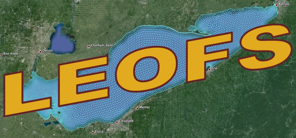
NOAA's National Ocean Service (NOS) collaborated with the Great Lakes Environmental Research Laboratory (GLERL) in developing and transitioning the new generation of Lake Erie Operational Forecast System (LEOFS) to operations. The upgraded LEOFS uses the Finite Volume Community Ocean Model (FVCOM) as its core circulation model and has extended the forecast horizon to 120 hours. It will provide higher-resolution forecast guidance of water level, currents and water temperature to support the maritime user community in navigation, emergency response, ecological forecasts and so forth.
NOAA's National Ocean Service (NOS) collaborated with the Great Lakes Environmental Research Laboratory (GLERL) in developing and transitioning the Lake Michigan and Huron Operational Forecast System (LMHOFS) to operations, to provide higher-resolution forecast guidance of water level, currents and water temperature. The upgraded LMHOFS, combining Lake Michigan and Lake Huron into one model grid, uses the Finite Volume Community Ocean Model (FVCOM) as its core ocean circulation model and has extended the forecast horizon to 120 hours. It is expected to generate a more accurate model output than the former LMOFS and LHOFS, which have separate model domains based on the Princeton Ocean Model (POM).

NOS created the Lake Ontario Operational Forecast System (LHOFS) to provide the maritime community with improved short-term predictions of water levels and currents in the Lake Ontario. Be advised that these predictions are based on a hydrodynamic model and, as such, should be considered as computer-generated forecast guidance.

NOS created the Lake Superior Operational Forecast System (LSOFS) to provide the maritime community with improved short-term predictions of water levels and currents in the Lake Superior. Be advised that these predictions are based on a hydrodynamic model and, as such, should be considered as computer-generated forecast guidance.
Operational Forecast System Regions: Pacific
Cook Inlet Operational Forecast System (CIOFS) was developed by the NOAA/National Ocean Service/Office of Coast Survey in a joint project with the NOAA/NOS/Center for Operational Oceanographic Products and Services (CO-OPS) and the NOAA/National Weather Service/National Centers for Environmental Prediction (NCEP) Central Operations (NCO) using Rutgers University's Regional Ocean Modeling System (ROMS). CIOFS generates water level, wind, water temperature, salinity, and current nowcast and forecast guidance out to 48 hours, four times per day.
The Salish Sea and Columbia River Operational Forecast System (SSCOFS) was developed as part of a joint project of the NOAA/National Ocean Service's Center for Operational Oceanographic Products and Services (CO-OPS) and Office of Coast Survey, the NOAA/National Weather Service's (NWS) National Centers for Environmental Prediction Central Operations, the Battelle - Pacific Northwest National Laboratory, and the University of Massachusetts-Dartmouth.
The SSCOFS runs on NOAA's Weather and Climate Operational Supercomputing System (WCOSS) in a Coastal Ocean Modeling Framework developed by CO-OPS, and it provides the maritime user community with nowcast (analyses of present conditions) and forecast guidance of water levels, currents, water temperature, and salinity out to 72 hours, four times per day.
NOAA's National Ocean Service (NOS) has developed a San Francisco Bay Operational Forecast System (SFBOFS). SFBOFS is based on a three-dimensional FVCOM model that runs on NOAA's High Performance Computing System (HPCS). SFBOFS provides water levels, currents, water temperature and salinity nowcast and forecast guidance as well as interpolated winds from National Weather Service products for two subdomains: the San Francisco Bay and the San Francisco Bay Entrance. SFBOFS runs four times per day and generates 6-hour nowcasts and 48-hour forecast guidance. SFBOFS products include time series graphics at station locations and aerial animations of the San Francisco Bay for all five parameters (winds, water levels, currents, temperature and salinity).
NOAA's National Ocean Service (NOS) collaborated with the National Environmental Satellite, Data, and Information Service (NESDIS) in developing and transitioning the new West Coast Operational Forecast System (WCOFS) to operations. WCOFS is based on the Regional Ocean Modeling System (ROMS). It assimilates real-time observation using ROMS' 4DVAR and provides water level, currents, water temperature, and salinity nowcast and forecast guidance out to 72 hours.