The Lake Ontario Operational Forecast System (LOOFS)
This FVCOM-based Lake Ontario OFS replaced the POMGL-based system in operations during the 10/25/2022/12Z forecast cycle.
Oceanographic nowcast and forecast guidance are scientific predictions about the present and future states of a water body (generally including water levels, currents, water temperature and salinity). These predictions rely on either observed data or forecasts from large-scale numerical models. A nowcast incorporates recent (and often near real-time) observed meteorological, oceanographic, and/or river flow rate data and/or analyzed (e.g. gridded) meteorological and oceanographic products. A nowcast covers the period of time from the recent past (e.g., the past few days) to the present, and it can make predictions for locations where observational data are not available. Forecast guidance incorporates meteorological, oceanographic, and/or river flow rate forecasts and makes predictions about the future states of a water body. A forecast is usually initiated by the state of a nowcast.
NOAA's National Ocean Service (NOS) collaborated with the Great Lakes Environmental Research Laboratory (GLERL) in developing and transitioning the new generation of Lake Ontario Operational Forecast System (LOOFS) to operations, to provide higher-resolution forecast guidance of water level, currents and water temperature. The upgraded LOOFS uses the Finite Volume Community Ocean Model (FVCOM) as its core circulation model. It is coupled to unstructured grid version of Los Alamos Sea Ice Model (UG-CICE) to provide additional forecast guidance of ice concentration, ice thickness and ice velocity. The forecast horizon is extended to 120 hours. It is expected to generate a more accurate model output than the former LOOFS, which is based on the Princeton Ocean Model (POM).
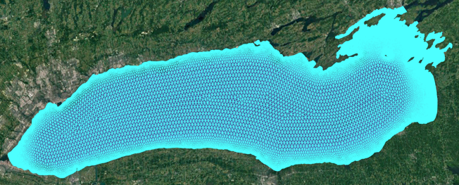
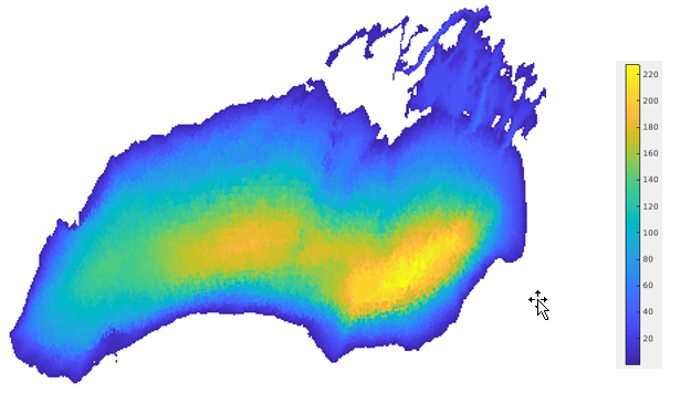
The LOOFS model grid has 34,395 nodes and 64,453 elements. The cell size ranges from 200 m to 2.5 km, with higher resolution along the shoreline. The grid has a minimum depth of 0.5 m and maximum depth of 227.8 m. The model has 21 vertical sigma layers.
Nowcast surface forcing are from NCEP's hourly updated High-Resolution Rapid Refresh (HRRR) atmospheric model and forecast surface forcing are from the hybrid of the available HRRR model output and the National Digital Forecast Database (NDFD) model output. USGS and Canadian Real-time river discharge observations from 8 river gauges are provided to drive the model. The unaccounted inflow/outflow due to combination of inflow from additional tributaries, runoff, and over lake precipitation and evaporation is estimated by the offset of the recent observed water level change (and the subsequent water volume change of the lakes) and the known water point source contributions. This unaccounted infow/outflow then will be imposed back into the surface forcing either as pseudo precipitation/evaporation depending on its positive/negative value.
LOOFS runs four times per day with 6-hour nowcast and 120-hour forecast for each cycle on the NCEP's Weather Climate Operational Supercomputer (WCOSS).
LOOFS output files are in NetCDF format. An archive of LOOFS NetCDF nowcast and forecast files can be accessed from CO-OPS THREDDS server.
All CO-OPS official real-time products, including nowcast and forecast guidance from LOOFS are monitored by the CO-OPS's Continuous Operational Real-Time Monitoring System (CORMS). CORMS provides 24 hour per day, 7 day per week monitoring and quality control of sensors and data in order to ensure the availability, accuracy, and quality of water level, current, and other marine environmental information. CORMS is intended to identify invalid and erroneous data and information before application of the data by real-time and near real-time users.

